Explore the most expansive United States map options designed for classrooms, offices, or home study. This guide reviews large-format maps that balance durability, readability, and versatile use—ideal for teaching geography, planning travel, or visual displays. Each pick emphasizes size, durability, and clear labeling to support both teaching and independent learning.
The following quick-reference table highlights the five best large US map options reviewed in this article, including size, format, and ideal use cases.
| Product | Size / Format | Best For |
|---|---|---|
| 48×78 Huge United States, USA Classic Elite Wall Map Laminated | 48″ x 78″ (Laminated) | Large classrooms, presentations, wall displays |
| 24×36 United States, USA Classic Elite Wall Map Mural Poster (Laminated Rolled) | 24″ x 36″ (Laminated, rolled) | Small to medium spaces, educational rooms |
| Laminated World Map & US Map Poster Set – 18″ x 29″ | 18″ x 29″ each (laminated) | Multiple context displays, combined world and US view |
| Palace Learning Laminated USA Map – 18″ x 29″ | 18″ x 29″ (laminated) | Back-to-school decor, durable classroom posters |
| United State Map Laminated Poster – 17 x 23 inch | 17″ x 23″ (laminated) | Individual study spaces, compact wall decor |
Huge United States Wall Map Laminated – 48×78

The 48×78 Huge United States Wall Map from Swiftmaps is designed for prominent visibility in large spaces. The front-sheet UV coated laminate supports dry-erase usage, enabling frequent updates for lessons, planning sessions, or business presentations. This map emphasizes a clear, large layout with durable construction suitable for classrooms, offices, or home study areas. The oversized format makes it easy to annotate during lessons or strategy sessions, helping learners grasp state locations, capitals, and major geographic features at a glance.
24×36 United States Classic Elite Wall Map (Laminated Rolled)

This 24×36 inch US map offers a balanced option between size and portability. Laminated and rolled for easy storage, it is suited for classrooms, offices, or homes with moderate wall space. It includes clear state boundaries and major cities, supporting geography lessons, travel planning, or display purposes. The rolled delivery protects the laminate during transit and ensures a pristine finish upon arrival.
Laminated World Map & US Map Poster Set (18″ x 29″)

The set pairs a world map with a United States map, both sized at 18″ x 29″ and laminated for durability. This combination is ideal for cross-context displays—teachers can compare global geography against the US map, while students can reference both maps in a single room. The laminated coating protects against spills and stains in busy teaching environments.
Palace Learning Laminated USA Map (18″ x 29″)
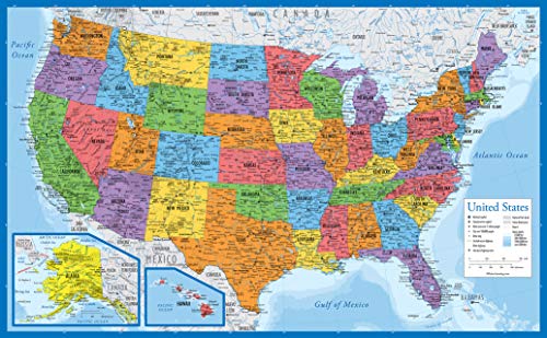
This Palace Learning poster emphasizes updated content and durability with a 3 MIL laminate. The 18″ x 29″ size fits well in classrooms, study corners, or smaller learning spaces. It is designed for repeated handling, marking, and annotation, making it suitable for geography lessons, quizzes, and group activities that require quick visual references of states and capitals.
United State Map Laminated Poster – 17 x 23

Compact in size yet robust in build, this 17 x 23 inch laminated poster is ideal for smaller classrooms or personal study spaces. The California design motif highlights key features and ensures the map remains a visually engaging resource for learners. Rolled shipping adds protection during transit and ensures a flat, pristine final product for display use.
24×36 United States Classic Elite Wall Map Mural (Laminated)
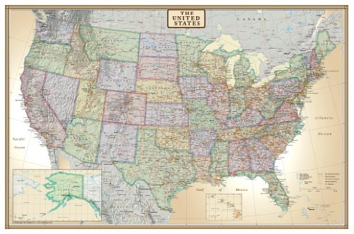
This 24×36 inch map from Swiftmaps offers a rolled format with dual-sided lamination for dry-erase use. It suits mid-to-large spaces where a sturdy wall map is needed for ongoing instruction or display. The laminated surface provides longevity in classrooms, home study areas, and training rooms where frequent updates and note-taking occur.
24×36 United States Classic Elite Wall Map (Folded)
This folded version of the Classic Elite map provides a practical option for spaces that require a compact setup when not in use. It remains suitable for teaching and study purposes with a durable poster paper base, making it accessible for both schools and at-home learning environments.
Buying Guide: Large US Maps For Classrooms And Offices
- Size and viewing distance: Larger maps (like 48×78) are best for big classrooms, conference rooms, or open-plan spaces. Smaller sizes (18×29, 17×23) fit compact rooms, study corners, or personal desks.
- Durability: Laminated surfaces resist stains and marks, enabling multiple uses with dry-erase markers or wet-erase pens. Consider triple lamination or UV coating for high-traffic areas.
- Format and delivery: Rolled maps are ideal for easier transport and long-term storage, while laminated folded maps may offer quick deployment in limited spaces.
- Learning focus: If teaching geography broadly, a world map paired with a US map can help relate global context to national details. For state-level lessons, larger US-focused maps provide better legibility.
- Visual clarity: Look for maps with legible city labels, clearly defined borders, and updated political boundaries. High-contrast colors improve readability from a distance.
- Use case versatility: Wall displays suit classrooms and offices; rolled and laminated maps are handy for teachers who rotate content or move displays between spaces.
- Accessories and maintenance: Wipeable lamination eases cleanup and annotation. Ensure the map’s edges are well-bound to prevent peeling over time.
- Budget and durability balance: Large-format laminates may carry a higher upfront cost but can reduce replacement needs due to wear in busy environments.
- Regional emphasis: For specific teaching goals (e.g., travel planning or regional studies), prioritize maps with clear state boundaries and geographic detail relevant to the curriculum.
- Safety and shipping: Consider rolled delivery when possible to avoid creases. Ensure packaging protects corners and edges during transit.
In summary, selecting a large United States map depends on space, usage frequency, and the need for durable, legible visuals. The options reviewed here span oversized wall displays to compact, durable posters, enabling educators, students, and professionals to choose a map that best fits their learning or presentation environment.