The best North America map print depends on whether you need detailed geographic reference, a laminated wall display, or a compact classroom chart. The MapSherpa Atlas of Canada map is best for detailed continent-wide reference, while the Gifts Delight political map offers a laminated poster format. Teacher Created Resources is a chart option, and the National Geographic and Palace Learning prints are United States maps rather than full North America maps.
| Map | Best For | Coverage or Format |
|---|---|---|
| MapSherpa Atlas of Canada | Detailed geographic reference | North America, 34 × 39 inches, laminated |
| Gifts Delight Political Map | Laminated wall display | North America, 24 × 28 inches |
| Teacher Created Resources Map Chart | Classroom chart use | North America map chart |
| National Geographic Classic Map | U.S.-focused wall display | United States, 36 × 24 inches |
| Palace Learning USA Map | Compact U.S. reference | United States, 18 × 29 inches, laminated |
MapSherpa Atlas of Canada North America Map

Best for: Buyers who want a large, information-rich North America reference map. This laminated 34-by-39-inch flat map uses a 1:10,000,000 scale and shows populated places, transportation routes, and drainage networks.
Countries and dependencies are distinguished by land-area colors. Three inset maps cover the Aleutian Islands, Hawaii, and North America’s relief and significant mountain elevations. A table lists road mileages between major cities, making this a strong choice when geographic detail matters more than a decorative-only design.
Limitation: Its large dimensions require more wall space than the smaller poster options. It ships tubed, so it arrives rolled rather than flat.
Gifts Delight Laminated Political Map

Best for: Buyers seeking a mid-size political map poster with a protected finish. The 24-by-28-inch print is laminated, and the product description identifies it as tear resistant with bold, vivid colors.
The map is printed on 24-pound photo gloss paper and heat-sealed with lamination. Its listed dimensions make it a more manageable wall display than the 34-by-39-inch MapSherpa map. Choose this option if laminated poster construction and political map presentation are priorities.
Limitation: The supplied details do not specify a map scale, inset maps, or the individual geographic features shown. Check the listing image and description if you need particular place names or reference details.
Teacher Created Resources North America Map Chart
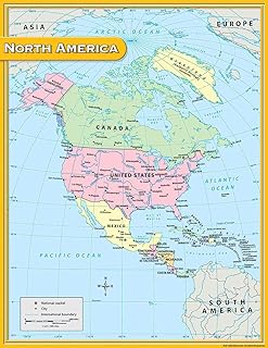
Best for: Buyers looking specifically for a multicolor North America map chart, including shoppers comparing classroom-oriented chart products. The product name confirms North America coverage and a multicolor presentation.
The available specifications identify the country of origin as the United States and give package dimensions of 3.5 inches in height and 24.5 inches in length. Consider this chart if a straightforward map display is your goal and you do not need the explicitly listed scale and inset information found on the MapSherpa map.
Limitation: The supplied product details do not state the chart’s map scale, finished dimensions, paper or coating type, or geographic features. Confirm those details before buying if they affect your display or teaching needs.
National Geographic United States Classic Map

Best for: Buyers whose search for a North America print is actually about the United States. The product is a 36-by-24-inch, poster-size United States classic wall map described as an art-quality print.
Its larger rectangular format may suit buyers who want a U.S.-focused display rather than a continent-wide map. Choose it when national coverage is the intended subject; it is not a substitute for a map showing Canada, Mexico, and the rest of North America.
Limitation: The product title identifies United States coverage, not all of North America. The provided information does not specify lamination or a map scale.
Palace Learning Laminated USA Map

Best for: Buyers who need a laminated map of the United States in a relatively compact 18-by-29-inch wall-chart format. The product title describes it as updated and made in the USA.
This is a better fit than a continent-wide print when the intended reference is specifically the United States. Its laminated finish is a distinguishing listed feature compared with the National Geographic print, whose supplied description does not mention lamination.
Limitation: This is a USA map, not a full North America map. The supplied details do not list its scale or the specific geographic labels and features included.
Buying Guide: How to Choose a North America Map Print
Do you need the whole continent or just the United States?
Start by confirming coverage. The MapSherpa, Gifts Delight, and Teacher Created Resources products are described as North America maps. The National Geographic and Palace Learning products are United States maps. If you need to compare countries across the continent, choose a product explicitly identified as North America.
Which map features matter most?
For named geographic detail, look for a listed scale, transportation routes, drainage, relief information, or city-mileage tables. MapSherpa explicitly lists these features. The other product descriptions provide less geographic detail, so review their listing images and descriptions before choosing them for a specific lesson or reference task.
Should you choose laminated or unlaminated?
Lamination is explicitly listed for MapSherpa, Gifts Delight, and Palace Learning. Gifts Delight also describes its poster as tear resistant and heat sealed. The supplied details do not confirm lamination for the other two options. If frequent handling is expected, compare finish details rather than assuming every wall map is protected.
How much wall space is available?
Compare stated print dimensions with the intended display area. MapSherpa is the largest listed North America option at 34 by 39 inches; Gifts Delight is 24 by 28 inches. The two United States alternatives are 36 by 24 inches and 18 by 29 inches. Dimensions can help narrow the choice, but they do not indicate how much detail will be legible at a distance.
Frequently Asked Questions
What is the best North America map print for geographic detail?
The MapSherpa Atlas of Canada map lists a 1:10,000,000 scale, populated places, transportation routes, drainage, relief insets, and road mileages between major cities.
Which listed North America map is laminated?
The MapSherpa 34-by-39-inch map and the Gifts Delight 24-by-28-inch political poster are explicitly described as laminated.
Are the National Geographic and Palace Learning maps continent-wide?
No. Their product titles identify them as maps of the United States, so they do not replace a North America map.
Which North America print has the smallest stated dimensions?
Gifts Delight is listed at 24 by 28 inches. Teacher Created Resources does not provide finished map dimensions in the supplied product details.
Which map is suited to a classroom chart display?
Teacher Created Resources is explicitly named a North America map chart. Check the listing for finished size and map details if those specifications are essential.