Large U.S. maps with clearly labeled states are ideal for classrooms, offices, and home study areas. The following selections highlight big, durable wall maps that are easy to read from a distance, suitable for dry-erase or laminated use, and designed to stay accurate for years. The list focuses on high-visibility posters and laminated sheets that cover the entire United States, helping users learn geography, plan travels, or display data at a glance. Below is a quick summary of the featured products.
| Product | ||
|---|---|---|
| 48×78 Huge United States, USA Classic Elite Wall Map Laminated | 48 x 78 inches | Front-Sheet Lamination (UV coated) |
| Maps International Giant Classic USA Mega-Map | 46 x 80 inches | Laminated (front sheet) |
| Laminated World Map & US Map Poster Set | 18 x 29 inches per poster | Laminated (3 mil) |
| 24×36 United States Classic Elite Wall Map Mural Poster | 24 x 36 inches | Poster (folded) |
| 24×36 United States US Executive Wall Map Poster Mural | 24 x 36 inches | 3 mil laminated (double-sided) |
48×78 Huge United States Wall Map Laminated

This Swiftmaps giant wall map offers an expansive 48 by 78 inches of U.S. geography with state boundaries clearly delineated. The front-sheet UV-coated laminate supports dry-erase usage, making it durable for daily classroom or office activities. Ideal for large wall spaces, this map helps users visualize the country at a macro level while enabling frequent updates or notes as needed.
Maps International Giant Classic USA Mega-Map Poster

Designed by expert cartographers, this 46 x 80-inch map stands out as one of the largest single-sheet U.S. maps available. It features vibrant colors and detailed boundaries suitable for classrooms, offices, or large family rooms. The laminated front sheet provides a write-on surface that cleans easily, supporting interactive lessons or planning sessions in any setting.
Laminated World Map & US Map Poster Set

This two-poster set includes a world map and a United States map, both laminated for durability. Each poster measures 18 by 29 inches, making it a compact yet informative option for smaller spaces or mixed geography displays. The laminated coating provides a wipe-clean surface suitable for classrooms or study corners that require frequent updates without wear.
24×36 United States Classic Elite Wall Map Mural Poster
This 24 x 36-inch folded poster offers a versatile and affordable option for displays where wall space is limited. It highlights state borders and major geography elements, making it a practical choice for homes, classrooms, or offices seeking a durable, high-visibility map that can be easily relocated or stored when not in use.
24×36 United States Executive Wall Map Poster
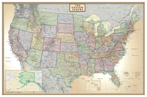
This executive wall map provides a large 24 by 36-inch display with double-sided laminated protection. The dry-erase surface is suitable for frequent planning and note-taking, making it a solid option for professional environments or lesson spaces that require a sturdy, long-lasting map with clear state boundaries and labeled features.
Buying Guide: Key Purchase Considerations
When choosing a big U.S. map with states, consider size, durability, finish, and intended use. Large formats (46–80 inches) offer high visibility for classrooms and open spaces, but require ample wall space. Laminated or dry-erase options support frequent updates and reuse, while posters provide a budget-friendly solution for temporary setups.
- Size and readability: For crowded rooms or classrooms, larger maps improve legibility from a distance. Measure wall space before purchasing.
- Finish and durability: Laminated front sheets and dry-erase surfaces prevent wear and allow frequent annotations. Double-sided lamination adds durability for high-traffic areas.
- Detail level: Some maps emphasize political boundaries, while others highlight physical features, transportation routes, or educational graphics. Align with learning goals.
- Assembly and mounting: Folded posters are easier to transport; laminated sheets often require proper mounting hardware to stay flat on walls.
- Update frequency: If you need current political boundaries or new state data, choose maps produced by reputable cartographers or publishers with regular updates.
- Multi-map sets: For broader geographic context, consider sets that include a world map alongside the U.S. map to facilitate comparative learning.
In summary, the best big U.S. map with states balances size, durability, and readability for your space. Whether you prefer an ultra-wide 46–80 inch display or a durable laminated sheet for daily use, the options above cover diverse environments—from classrooms to executive offices. Each item is designed to help users explore geography with clear delineations, up-to-date boundaries, and practical finishing options that support ongoing learning and planning.